
The Mitchell County Water Quality Sampling Program provides a direct return on investment by ensuring that local decisions are informed by measured, locally collected data rather than assumptions or outside estimates.
This program allows the Mitchell County to:
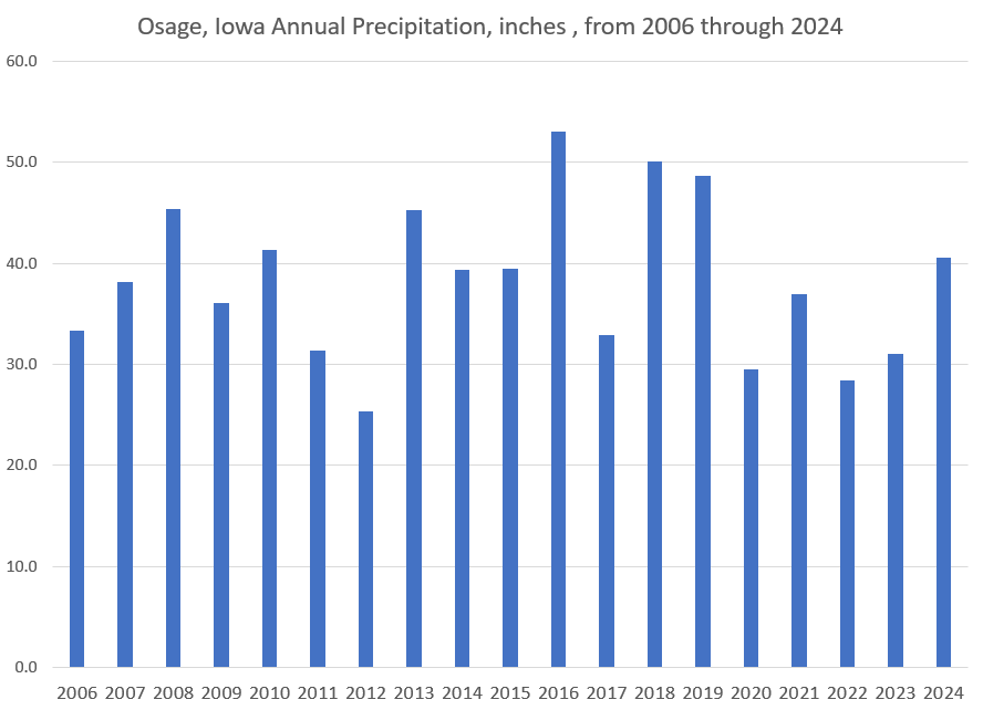
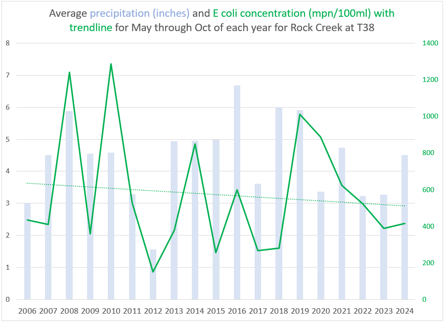
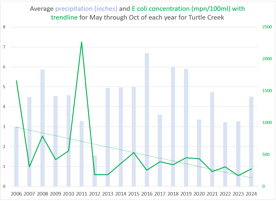
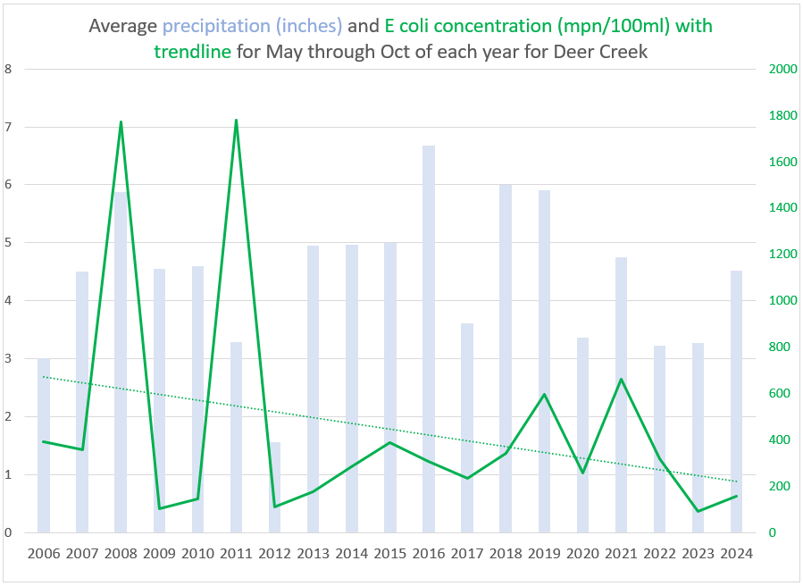
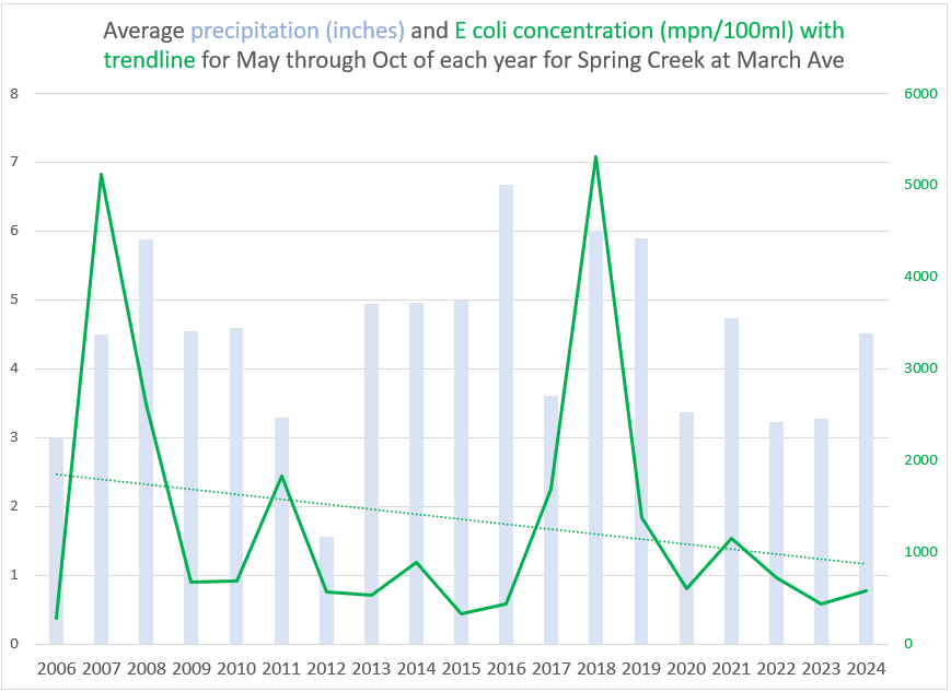
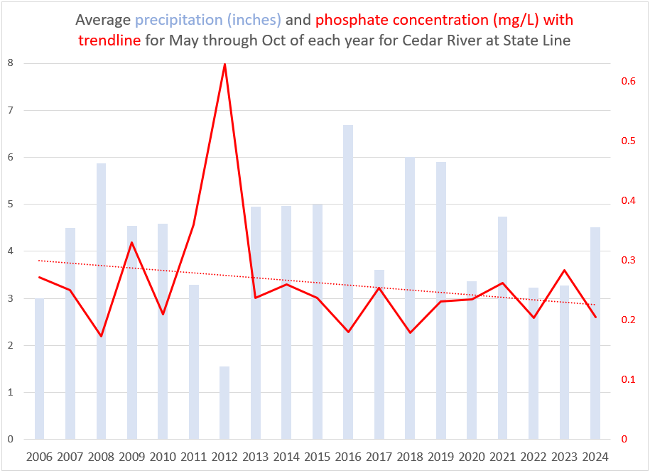
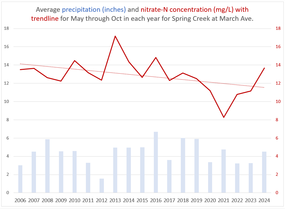
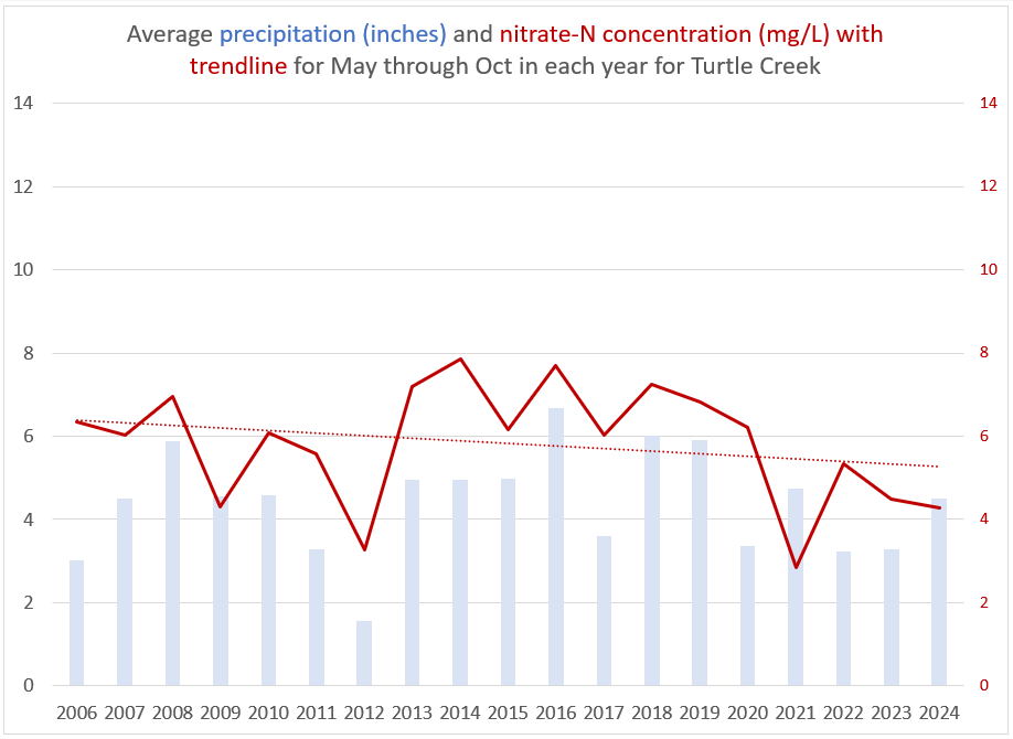
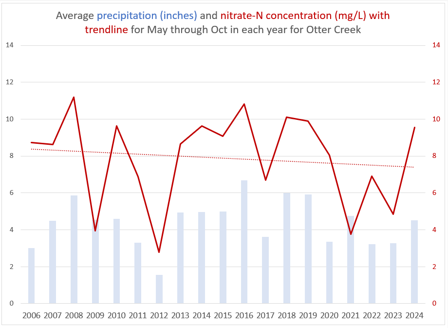
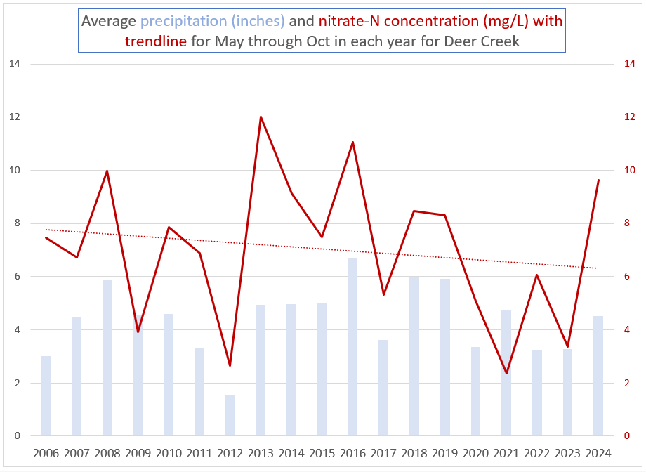
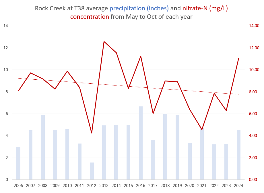
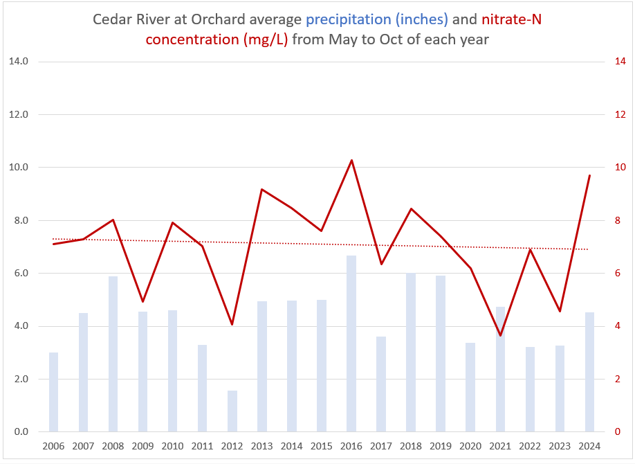
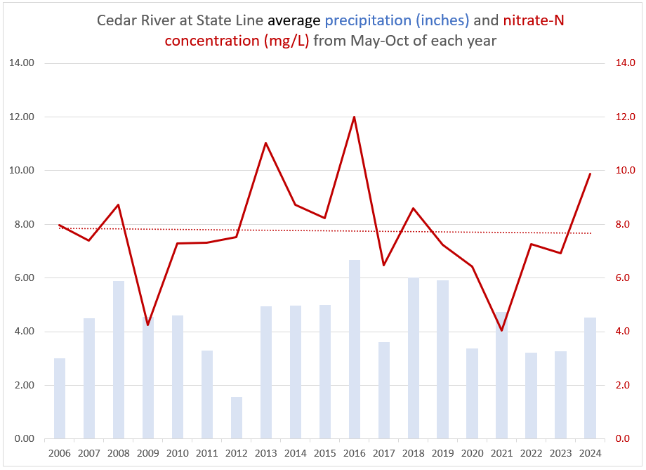
Beginning in 2006, Mitchell County initiated a water quality sampling program to document baseline conditions on the Cedar River and its primary tributaries. Since that time, sampling and data collection have expanded to include nearly every major stream within the county. The program was originally a partnership between the Iowa Department of Natural Resources (IDNR), the Mitchell County Conservation Board, and the Mitchell Soil and Water Conservation District (SWCD). However, in 2017, due to budget cuts, the IDNR was forced to withdraw as a partner. The Mitchell County Board of Supervisors (BOS) joined in 2018 and provided funding, allowing the program to continue. At that time, responsibility for data storage, management, and interpretation transitioned from IDNR to the Mitchell SWCD.
Over the past year, awareness of the data set has increased. University contacts have expressed interest in utilizing the data for research purposes, and the project has been uploaded to an academic data portal where graduate students may evaluate it for research projects.
By maintaining county-owned data, Mitchell County retains control over how information is interpreted and used, ensuring that decisions affecting land use, conservation practices, and future funding requests are based on local conditions and priorities.
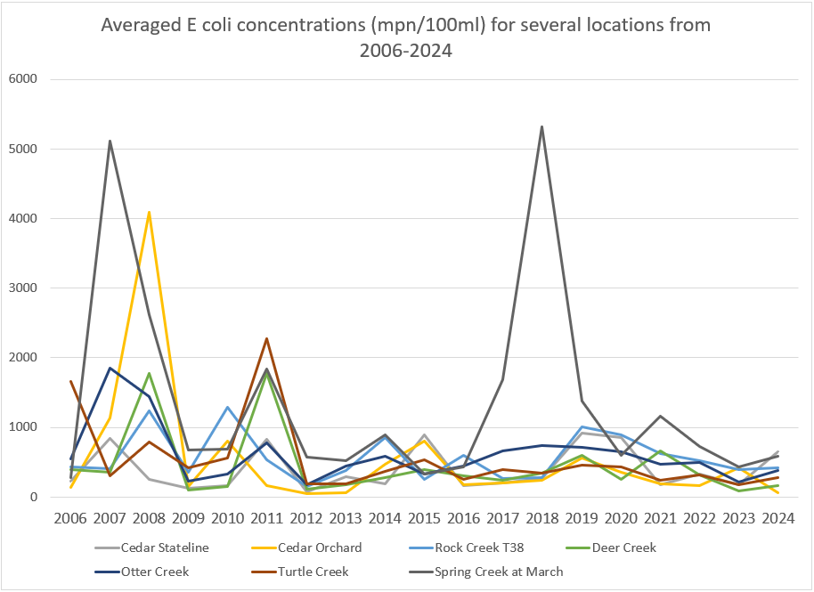
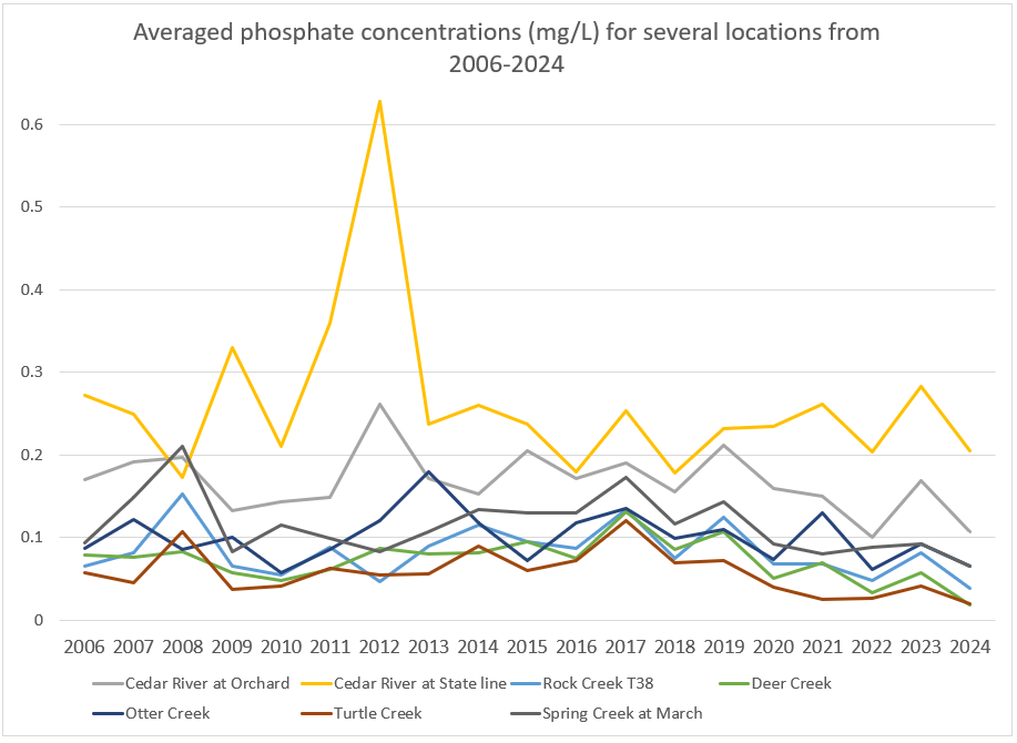
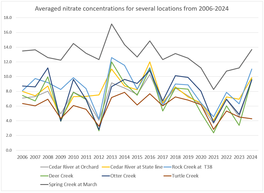
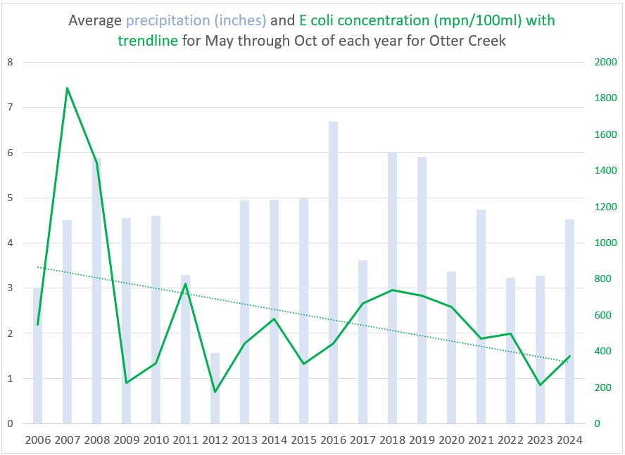
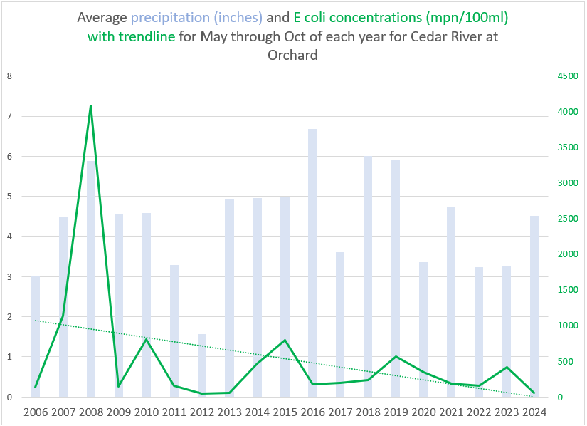
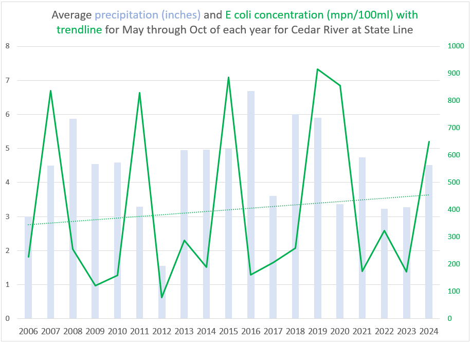
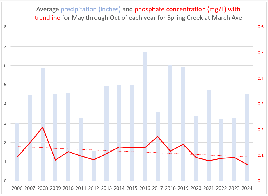
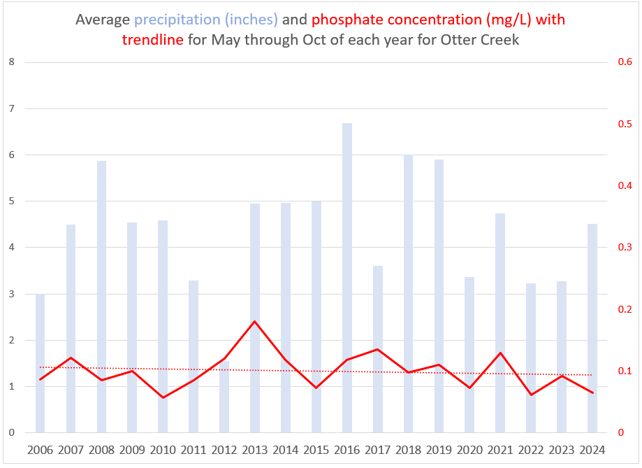
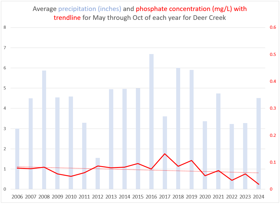
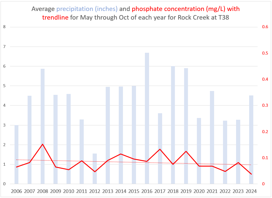
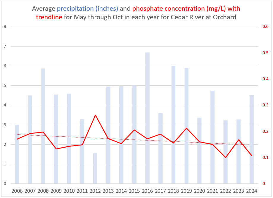
Long-term trend analysis indicates that water quality measurements on major streams and tributaries have remained relatively stable over time. Based on these findings, the group agreed to shift future monitoring efforts toward locations with less historical data to develop baseline conditions within those watersheds.